Sample design
This is actual engine output.
A real MACRILON package for a 510-home suburban service area: boundary and address
roster in, everything below out — untouched by hand. Identifying details (market name, addresses) are
removed; the design itself is exactly what the engine produced.
Plan map & route, side by side
The same network two ways: the construction plan over aerial imagery (what the permit desk and field crews use) and the clean route schematic (what the engineer reviews). In the portal these render interactively next to every workbook sheet.
Construction plan aerial basemap
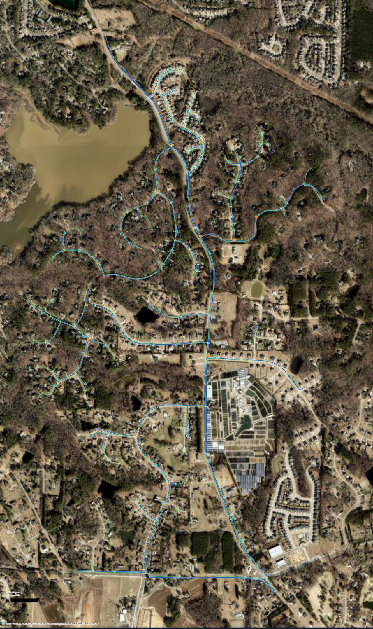
Conduit (blue) and fiber distribution with handholes, as delivered in the package PDF. Basemap © Esri World Imagery.
Route schematic CAD plan sheet
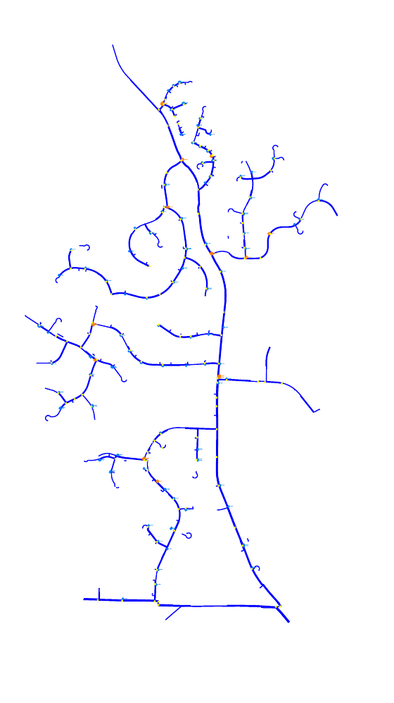
The same design's vector plan sheet — distribution tree, splitter and handhole placements — exported to CONSTRUCTION.dwg / .dxf.
The numbers behind the picture
Pulled from the delivered workbook for this design. Every figure below is also a line in the .xlsx your engineers receive.
| Network design | |
|---|---|
| Homes passed / serviceable | 510 |
| Primary splitters (1×8) | 17 |
| Secondary splitters (1×4) | 112 |
| Handholes | 121 |
| Total cable footage | 150,669 ft |
| Conduit (trench) footage | 60,842 ft |
| Node utilization | 8.3% of 6,144-home node |
Build-readiness 92 / 100 — issue-ready
Scored per design across homes, footage, rules, permits, and cost confidence — shipped with every package so your reviewer knows where to look first.
Scored per design across homes, footage, rules, permits, and cost confidence — shipped with every package so your reviewer knows where to look first.
| Costed bill of materials | |
|---|---|
| Buried construction labor | $608,417 |
| Cable material | $114,508 |
| Splitter material | $26,960 |
| Permits | $10,000 |
| Provisioning + tax allowance | $21,928 |
| Total estimated job cost | $781,813 |
Costed at reference unit rates; in production your rate card drives the same line items.
The min-cost design mode priced this network at $601,980 (−23%) with 46,070 trench ft — delivered
alongside the match-mode design as a value-engineering reference.
What the full package adds
Beyond what's shown here, the delivered package includes the complete multi-tab workbook (splice plans, port maps, footage by cable class), the multi-sheet construction set (PDF), CAD (CONSTRUCTION.dwg/.dxf), a routed KMZ, the permit matrix from authoritative GIS, and the interactive map — all reviewable in the browser. We don't publish those artifacts here because they carry project-identifying detail; in a live demo you'll see them on a boundary of your choosing.
Book a live demo
30 minutes, your boundary. We'll run it live and walk the package with your engineers — the comparison against your own ground truth is the demo.